Engineers, like artists, often fall in love with their models.
Introduction
In a recent post, I discussed how to compute the distance of mountaintops from the center of the Earth. This computation was interesting because we had to take into account the oblate shape of the Earth.
This equatorial bulge is something that the Earth has in common with all other spinning planets. Jupiter, in particular, has a very pronounced bulge.
The fact that the Earth's equatorial diameter is slightly larger than its polar diameter can cause some interesting behavior. For example, centrifugal force at the equator causes the weight of objects at the equator to be slightly less than that of the same object at either pole.
Today, I saw the following problem in a book called "Thinking Like a Physicist" that illustrates that north-south flowing rivers can move further from the center of the Earth as they flow.
Explain (qualitatively and quantitatively) how the source of the Mississippi river can be about 5 km closer to the center of the Earth than is its mouth.
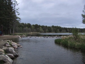
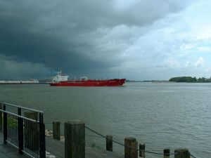
The tools I created to determine the distance of mountaintop from the center of the Earth can also compute the distance of Lake Itasca (Figure 1) and New Orleans (Figure 2) from the center of the Earth. Time to dig in ...
Background
All the background is included in this post, so just refer there for the details. There are many other web sources that discuss this problem. Here is a list of a few of these sources.
- Paddling Uphill
- Slicing Pizzas, Racing Turtles, and Further Adventures in Applied Mathematics
- The Flaming Sword, Volume 13
Analysis
All I needed to do was:
- Grab the latitude, longitude, and height above sea level of Lake Itasca and New Orleans from the Wikipedia.
- Compute the geoid corrections using software from the National Geospatial-Intelligence Agency. You can also compute the correction on this web site. The answers will vary based on the database and interpolation algorithm you use.
- Compute the distance from the center of the Earth from this web site.
Here is the output from my Excel spreadsheet that does calculations.
I have confirmed the "about 5 km" statement from the book "Thinking Like A Physicist". So we can state that the Mississippi river runs downhill with respect to sea level (aka geoid level) but not with respect to the center of the Earth.
You can also perform these calculations for yourself on this web page.
Conclusion
This was an interesting extension of my calculation efforts for the distance from mountaintops to the Earth's center. I rarely think about the role of the Earth's rotation on how our planet works. Yet, every night I look at the curved shapes of the weather fronts and I see the role of the Coriolis effect, which exists because of the Earth's rotation.
I live near the Mississippi River and writing about is fun. I plan on retiring in northern Minnesota, where the Mississippi River actually runs north for part of its course. It is a small, meandering river in this part of the country.


